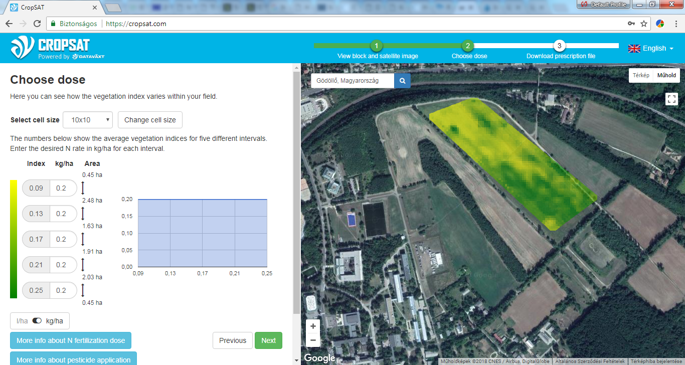
CropSAT is a tool to survey your field from above. Maps of the biomass variation within the field is calculated from satellite imageries. You can use the variation maps to see how your crop develops during the season and to control your N-application based on crop N need. CropSAT is an interactive application and allows you to easily create variation maps from the satellite imagery vegetation index. The maps can be downloaded and used for variable rate nitrogen application. CropSAT is, simply put, a crop sensing system for everybody.
This project is funded by the European Community Erasmus programme.